2) Via the Görfe to the Aifner Alm NPKG
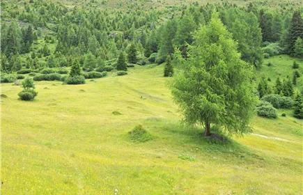
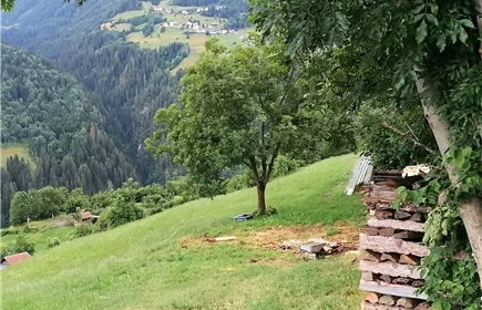
A little bit of forest, a little bit of moorland, a little bit of alpine pasture, and lots of hiking fun!
Medium
9,40 km
379 m
04:15 h
Medium
Route
9,40 km
379 m
452 m
04:15 h
1994 m
Starting Point
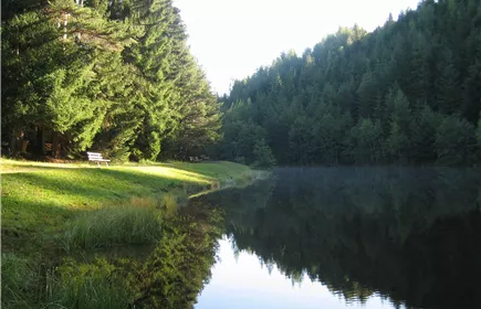
Harber Weiher
End Point
Harber Weiher
Description
From Harber Stadl, the trail leads along the forest road to Kalkofenegg, then continues along a forest path to Görfen Moor. Finally, it descends via the Aifner Alm back to the starting point.
Best Season
Jan
Feb
Mar
Apr
May
Jun
Jul
Aug
Sep
Oct
Nov
Dec
Elevation Profile & Characteristics
Skill Level
Endurance
Amenities
Sturdy shoes, weather-appropriate clothing, sunscreen, sufficient water, and snacks if necessary. Depending on the season, rain gear or cold weather protection is recommended.
Instructions
From Harber Stadl (location), follow the forest road to Kalkofenegg (highest point). Here, turn right at the fork in the road and hike first on the forest road and later on a steeper trail up to Görfen Moor. The trail runs along the southern edge of the moor and, after about 300 m, joins a forest road that leads to the Aifner Alm. Follow the forest road downhill and you will reach the Harbe from the Görfen Moor via the familiar route.
Path Conditions
Hiking trail, forest road
Public Transport
From Imst:
Take bus line 311 to the “Fließ Naturparkhaus” stop.
From Landeck:
Take bus line 240 to the “Fließ Naturparkhaus” stop. From the Naturparkhaus, it is about a 30-minute walk to the starting point.
(Check the timetable!)
Take bus line 311 to the “Fließ Naturparkhaus” stop.
From Landeck:
Take bus line 240 to the “Fließ Naturparkhaus” stop. From the Naturparkhaus, it is about a 30-minute walk to the starting point.
(Check the timetable!)
Parking
From Imst:
Follow the L16 Pitztaler Landesstraße to Wenns. In the village center, turn right towards the Kaunergrat Nature Park House and follow the L17 until you reach it. From there,
it is about a 30-minute walk to the starting point.
From Landeck:
Take the B180 (Reschenstraße) to the turnoff for Fließ. Then follow the L17 (Piller Landesstraße) uphill to the Kaunergrat Nature Park Center . From here, it is about a 30-minute walk to the starting point.
From Prutz:
Take the L250 (Kaunerbergstraße) to Kaunerberg, then continue on the L63 to the nature park center. From this point, it is about a half-hour walk to the starting point.
From the Kaune
First follow the L18 (Kaunertalstraße) to Grimstein, then the L64 towards Kauns. In the center of Kauns, turn right onto the L250 and continue on this road to Kaunerberg. There, turn
left onto the L63, which leads directly to the Nature Park Center. From there, it is about a 30-minute walk to starting point.
The parking lot is located in the immediate vicinity of the Kaunergrat Nature Park Center
and is well signposted. From the Nature Park Center, it is about a 30-minute walk to the starting point.
Follow the L16 Pitztaler Landesstraße to Wenns. In the village center, turn right towards the Kaunergrat Nature Park House and follow the L17 until you reach it. From there,
it is about a 30-minute walk to the starting point.
From Landeck:
Take the B180 (Reschenstraße) to the turnoff for Fließ. Then follow the L17 (Piller Landesstraße) uphill to the Kaunergrat Nature Park Center . From here, it is about a 30-minute walk to the starting point.
From Prutz:
Take the L250 (Kaunerbergstraße) to Kaunerberg, then continue on the L63 to the nature park center. From this point, it is about a half-hour walk to the starting point.
From the Kaune
First follow the L18 (Kaunertalstraße) to Grimstein, then the L64 towards Kauns. In the center of Kauns, turn right onto the L250 and continue on this road to Kaunerberg. There, turn
left onto the L63, which leads directly to the Nature Park Center. From there, it is about a 30-minute walk to starting point.
The parking lot is located in the immediate vicinity of the Kaunergrat Nature Park Center
and is well signposted. From the Nature Park Center, it is about a 30-minute walk to the starting point.
Author's Tip
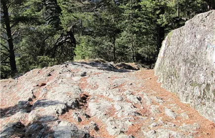
Not far from the Aifner Alm is the Aifner Stein. From here, you have a spectacular view of the Tyrolean Oberland and the Kaunergrat.