Eagle Walk Stage 20: Hanauer Hütte - Württemberger Haus
Long-Distance Hiking (from 5 stages)
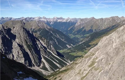
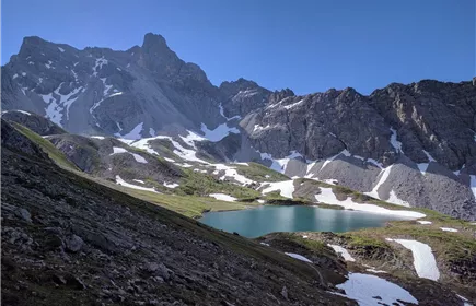
Once aloft on those airy plains between Inn and Lech Rivers, you'll be in a true Alpine environment. You can expect to have very few encounters on this trail so if you enjoy solitude, and a good work-out this trail is for you. This hike is famous for its sharp ridges and the feeling of remoteness its rugged terrain offers. However, you’ll need to turn your focus from the scenery to your feet as you tackle vigorously steep climbs, scree and talus slopes, large boulders and cliffs assisted by a fixed anchoring system of cables. You’ll gain East/Back Dremelscharte Notch and walk past a necklace of sparkling Alpine lakes, adorning bold mountain faces. For many hikers this walk is far enough, contentment has already set in. Adventurous souls who are up for the extra effort can take the detour for Schlenkersee Lake, an aquatic gem wrapped in gorgeous scenery just below East Dremelscharte Notch.
Hard
11,00 km
1240 m
07:00 h
Hard
Route
11,00 km
1240 m
930 m
07:00 h
2480 m
Starting Point
Hanauer Hütte
End Point
Württemberger Haus
Description
trail description: Right behind Hanauer Hut, follow signage to “Württemberger Haus”. Shortly after, the singletrack trail divides. Here, walk towards “Steinseehütte” (instead of “Württemberger Haus”). Right before reaching the creek, the path divides again. Here, “Steinseehütte” is way-marked twice. For East/Back Dremelscharte Notch, take Route No. 625 (to the left). From there, follow signage to “Steinseehütte”. Soon, the route climbs a steep slope, running into the basin between Dremelspitze Peak and Kleiner Schlenkerspitze Peak. After traversing the scree slopes, a well-defined singletrack trail steeply runs across a rubble cirque, heading towards East Dremelscharte Notch. In the very upper part, you have to cross a narrow, debris-filled gully assisted by a fixed anchoring system of cables. On the other side, the singletrack trail descends rather steeply across meadows, and then continues to descend to Steinsee Hut more gradually, passing picture-postcard Steinsee Lake.
From the hut, the route descends a few metres again before gently ascending to Steinkar Cirque. Beyond, you traverse tussock slopes and scree slopes. A short distance ahead, the path steeply climbs across rocks and afterwards across scree up to Roßkarscharte Notch. Beyond the notch, steeply descend in a narrow rock gully (some cable safeguards) and thereafter in a...
From the hut, the route descends a few metres again before gently ascending to Steinkar Cirque. Beyond, you traverse tussock slopes and scree slopes. A short distance ahead, the path steeply climbs across rocks and afterwards across scree up to Roßkarscharte Notch. Beyond the notch, steeply descend in a narrow rock gully (some cable safeguards) and thereafter in a...
Best Season
Jan
Feb
Mar
Apr
May
Jun
Jul
Aug
Sep
Oct
Nov
Dec
Elevation Profile & Characteristics
Skill Level
Endurance
Amenities & Features
Multi-Day Tour Feature
Etappe