Lechtaler Höhenweg: 5th stage Memminger Hütte-Württemberger Haus
Long-Distance Hiking (from 5 stages)
Over summits and ridges, from hut to hut
Hard
6,97 km
629 m
04:15 h
Hard
Route
6,97 km
629 m
649 m
04:15 h
2649 m
Starting Point
Memminger Hütte
End Point
Württemberger Haus
Description
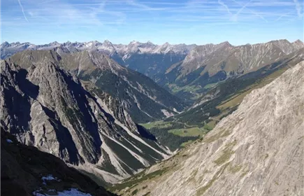
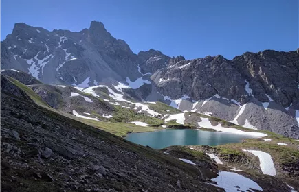
Shortly before the Mittlere Seewisee, the trail branches off to the Seescharte, a narrow notch between dark, jagged rock towers.
The subsequent traverse to the Großbergscharte proves to be a sunny promenade. The route then follows the main ridge for a long time, crosses the Großbergkopf to the Großbergspitze and thus reaches the highest point of the "official" high route.
The Württemberger Haus is located in the round basin of the Medriol.
The subsequent traverse to the Großbergscharte proves to be a sunny promenade. The route then follows the main ridge for a long time, crosses the Großbergkopf to the Großbergspitze and thus reaches the highest point of the "official" high route.
The Württemberger Haus is located in the round basin of the Medriol.
Best Season
Jan
Feb
Mar
Apr
May
Jun
Jul
Aug
Sep
Oct
Nov
Dec
Elevation Profile & Characteristics
Skill Level
Endurance
Amenities & Features
Multi-Day Tour Feature
Etappe
Amenities
Good equipment is essential for your hike. The following items should definitely be in your rucksack:
- Food and drink - Functional clothing for rain, wind and cold - A change of clothes - Sun protection - First aid kit - Mobile phone with a full battery (Euro emergency number 112) - Hiking map or GPS - Hiking poles
Nevertheless, the following applies: light luggage is also easier to carry, so you should not weigh down your rucksack with unnecessary ballast. In addition, your hiking equipment should of course also be adapted to your particular hiking tour.
- Food and drink - Functional clothing for rain, wind and cold - A change of clothes - Sun protection - First aid kit - Mobile phone with a full battery (Euro emergency number 112) - Hiking map or GPS - Hiking poles
Nevertheless, the following applies: light luggage is also easier to carry, so you should not weigh down your rucksack with unnecessary ballast. In addition, your hiking equipment should of course also be adapted to your particular hiking tour.
Path Conditions
Mountain path
Parking
Regiobus